 |
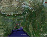
Beijing (XNA) Feb 21, 2007 Move over Google Earth, there's a new kid in town. Shanghai scientists have developed a three-dimensional (3D) mapping system that will allow users to see the sides of buildings, which is not possible to do using Google Earth. The Shanghai Evening Post reported the development under the headline "Shanghai map challenging Google Earth", but Shu Rong, the leader of the team at Shanghai Institute of Technical Physics that developed the program, described the headline as a bit of an exaggeration. "Actually we've just mended a little hole on Google Earth," he said. Shu added that the team's 3D mapping technology was still in the early stages of development and not quite ready for practical use. "We can create vivid digital maps with this system. Users will feel like they are hovering above a place when they look at the map," Shu said. "For example, we can design a 3D map for the World Expo park. With the aid of a webcam, users can get vivid pictures of a specific area - what the surroundings are like and whether a place is crowded." Google Earth provides a kind of virtual globe composed of satellite images. However, the images render the world in a two-dimensional format. When using the program to search for specific addresses or locations, it can be difficult to differentiate one building from another. Also, many streets are lined with trees, which can further complicate searches. To resolve this problem, Shu and his colleagues created a 3D map of parts of Suzhou. The 3D models are based on pictures taken from a helicopter equipped with special perspective-adjusting equipment. "We need to learn about the specific angles from which each picture was taken and then calculate the mapping," he said. "This approach is efficient, but expensive." A single hour-long flight costs 50,000 yuan (6,448 U.S. dollars). However, the high-definition pictures allow people to zoom in to clearly see the buildings. "We flew a bit too high this time, but we think the pictures can be reproduced more clearly," Shu said. Many scientists in China have been working on 3D imaging by taking pictures at the street level. And their counterparts in Western countries are at work on several other approaches to the technology. "We'd like to co-operate with Google Earth or other international companies, and put this technology in use," Shu said. "We're also hoping to push forward China's work in areas like this." He added that the goal of 3D mapping was to provide access to public spaces without invading people's privacy. 3D mapping holds out the possibility of changing the way people use maps. "If this technology is linked to the GPS orientation system, it will be convenient to use," said Xia Zheng, a young white collar. Source: Xinhua News Agency Community Email This Article Comment On This Article Related Links Making money out of watching earth from space today Earth Observation News - Suppiliers, Technology and Application
 Paris, France (ESA) Feb 20, 2007
Decision-makers, scientists and local authorities require up-to-date environmental information in order to manage natural resources, respond to natural disasters and better understand climate change. ESA has been responding to this requirement since 1992 by offering data from Earth-observing satellites in near-real time to allow users to study and monitor the current state of the oceans, lands, atmosphere and cryosphere. |
|
| The content herein, unless otherwise known to be public domain, are Copyright 1995-2006 - SpaceDaily.AFP and UPI Wire Stories are copyright Agence France-Presse and United Press International. ESA PortalReports are copyright European Space Agency. All NASA sourced material is public domain. Additionalcopyrights may apply in whole or part to other bona fide parties. Advertising does not imply endorsement,agreement or approval of any opinions, statements or information provided by SpaceDaily on any Web page published or hosted by SpaceDaily. Privacy Statement |