Mars Atlas 2002 - images by NASA, JPL and MSSS
Mars Atlas 2002 - images by NASA, JPL and MSSS |
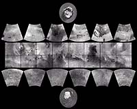
The planet was divided into thirty "quadrangles" or areas, each with an "Mars Chart" or "MC" number (MC-1 through MC-30). The equatorial region was portrayed in the Mercator projection, with Lambert Conformal Conic for the mid-latitudes and Polar Stereographic for the poles.
Although digital products such as the Mars Digital Image Mosaic (MDIM) and various Mars Global Surveyor (MGS) Mars Orbiter Laser Altimeter (MOLA) maps have partially supplanted the ATLAS, it remains a standard desktop reference today.
In 1999, the Mars Orbiter Camera (MOC) aboard the MGS orbiter acquired a global stereo image dataset using its red-filter Wide Angle Camera. We have recently completed a 256 pixel/degree (about 230 meters/pixel) mosaic of these images using software developed at Malin Space Science Systems (MSSS).
Related Links
 Pasadena - Oct. 26, 2000